


Subtotal: $355.82
🔸 This is actual program, full version. After purchasing you will receive installation file + license file (patch) for lifetime activation.
🔸 Please, if you are can not follow our instruction and not okay with this kind of activation then do not buy this product.
🔸 This particular version can not be updated❗
🔸 We are not selling any activation codes, serials or subscriptions❗
🔸 Download FIle Size: 133MB
🔸 Program available only for Windows OS
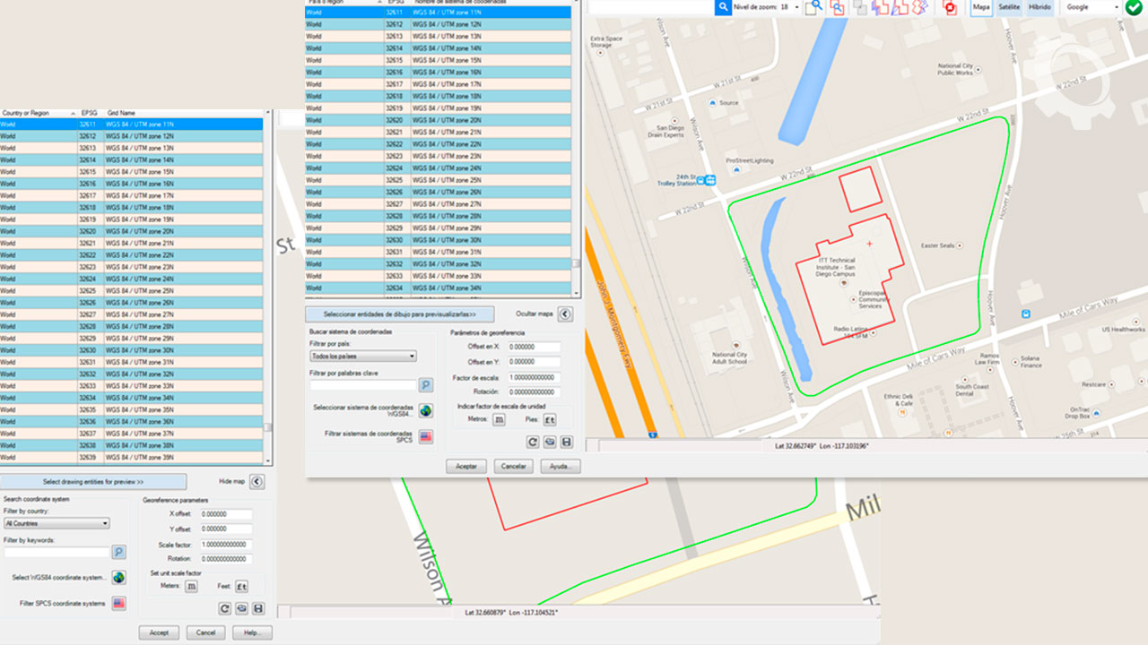
Insert images. You can select different service providers (Google, Bing, Yahoo, Ovi), image resolution (standard, medium, high, highest), and image mode (satellite, map, hybrid). Images can be imported to full-color CAD programs or grayscale in major image formats (BMP, JPEG, TIFF) and clipped inside a closed polyline. Create a world text file containing spatial data information to georeference imported images.
Export CAD objects to Google Earth. Lines, polylines, arcs, circles, and points can be exported to Google Earth as polygons, routes, or placemarks. Object line thickness, outline, fill color, and can adjust the opacity. Can control curve smoothness by specifying the maximum segment length and deflection angle? Can also set the placemark name, description, scale, and icon.
Get contour lines, profiles, and sections from Google Earth (Plus version). Create a terrain configuration mesh inside a closed polyline or along a polyline path calculating point elevations from Google Earth. Specifying the origin point, rotation angle, and distance between rows and columns can adjust the mesh density and precision. Can use the resulting mesh to obtain contour lines, dynamic profiles, and section drawings complete with annotations.
Only logged in customers who have purchased this product may leave a review.


Reviews
There are no reviews yet.