

Subtotal: $78.54
🔸 This is actual program, full version. After purchasing you will receive installation file + license file (patch) for lifetime activation.
🔸 Please, if you are can not follow our instruction and not okay with this kind of activation then do not buy this product.
🔸 This particular version can not be updated❗
🔸 We are not selling any activation codes, serials or subscriptions❗
🔸 Download FIle Size: 62MB
🔸 Program available only for Windows OS
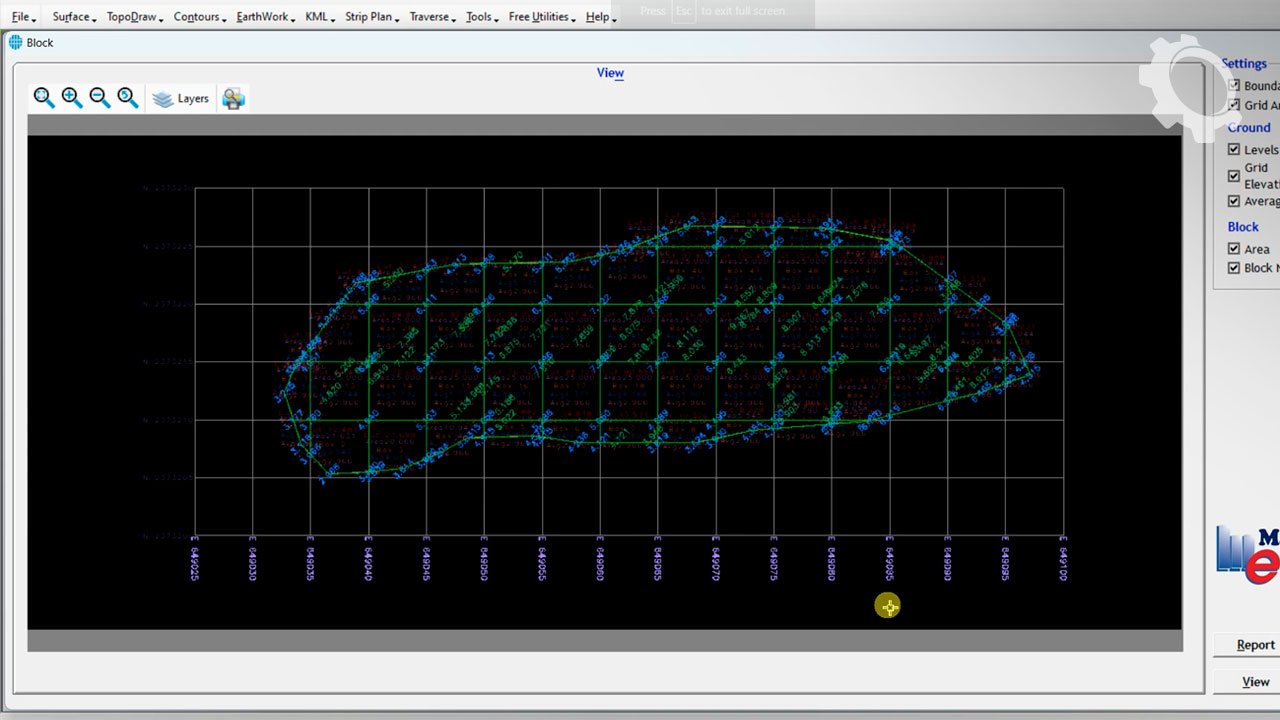
ESurvey CADD is a large software suite for civil and mapping engineers that is used to quickly create contours, segmentation for volume computation, excavation, and wall mapping, and convert point data to topographic maps. This software is a product of ESurveying Softech and offers comprehensive solutions for land line mapping, excavation calculation, longitudinal and cross cutting preparation, interpolation, and route correction.
ESurvey CADD software enables topographic maps to be quickly constructed from point data and converted into AutoCAD designs. You can also import data through the CSV, Excel or CAD file to this software and easily perform calculations with multiple tools. The suite also supports the Lisp scripting language and enables CAD users to work on mapping schemes.
Features and Features of ESurvey CADD Software:
Create Contours Quickly
Excavation and wall calculation
Divide to compute volume
Convert point information to topographic map
Lisp programming language support
Convert KML data in Google Earth to 2D maps
Only logged in customers who have purchased this product may leave a review.


Reviews
There are no reviews yet.